

Where was I?
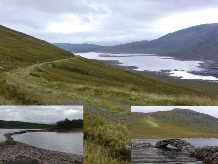
I like to find old tracks no longer in use. This was a Telford road built in the 1800's and in use as an A road until the late 1950's.
Part of the Road to the Isles....
Comments (7)
Please log in to add comments.
I've replaced the photo with a collage that shows the road entering Loch Loyne on the north side, and a close-up of the old north bridge that I (very cautiously) crossed in Sep 2013. The bridge has since fallen down. This old road went from Tomdoun to Cluanie. It's a nice short cycle from Cluanie, but be careful of disguised bike-eating potholes on the surfaced section down to Loch Loyne!. I must try the road from Tomdoun some time too. More here:
https://www.sabre-roads.org.uk/wiki/index.php?title=A87/Loch_Loyne
This looks like it: https://www.geograph.org.uk/photo/969138
I remember stopping at the Cluanie Inn after climbing The Saddle, but I always thought the 'Road to the Isles' was the A830!
That's the Inn
Cluanie?
Said Inn is where this old road joins the newer detour
I cycled the road from an isolated Inn. Wish I could add another photo showing the remains of the bridge below.
Road to the Isles should have been a big enough clue but I can't find this. A bit of help or the answer please, Dave.
© Image posters are the sole copyright owners of the image. Images may not be copied or used in any way without the express permission of the poster.